Roads are often made for communications and transportation. In Southern Africa during the latter half of the twentieth century, highways and railways were also inextricably entwined with diplomacy, security and politics.
You have particular issues if your country is landlocked and Southern Africa has a number of these states.
Zambia, Zimbabwe, Malawi and Botswana are all landlocked. This can be particularly problematic if you are trying to find a port to ship your minerals or other goods from.
Malawi
Malawi only had one major mineral resource available to it – bauxite – in the far south of the country at Mulanje. However reserves of bauxite could be found in other countries closer to ocean ports (for example in Mozambique) and so Malawi’s reserves remained largely undeveloped. In this way Malawi was a victim of its geography.
South Africa
The railway system in Southern Africa was dominated by South Africa. Many of the railways traveled on a north-south axis. This facilitated penetration into states to the north. In this way, railways provided easy access to the agricultural and mineral wealth that lay beyond South Africa’s borders. Even if the resources were owned by neighbouring countries, South Africa could benefit financially from transit revenue if they were shipped out of South African ports. These railways also allowed for the fast deployment of South African troops at times of conflict with northern neighbours.
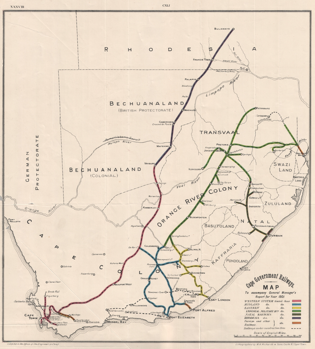
However this military asset was not without its vulnerabilities. Railroads don’t move. The tracks were obvious targets for sabotage. They could be rebuilt but it was an inconvenience for Pretoria and it took time to repair the lines every time they were blown up.
Namibia
In 1890 German South West Africa managed to extend their boundary closer to the Zambezi River through the Caprivi Strip. The Germans had wanted access to this major watercourse. They had thought that they would be able to connect their territory to the river and potentially use it to transfer goods to the other German colony in East Africa. However it was later confirmed that this wasn’t possible as Victoria Falls, the Kariba Gorge and Cahorra Bassa in Mozambique all presented obstacles to transporting freight along the Zambezi. The British were already aware of this that this was the case. Knowledge can be power.
The Caprivi Strip is a rare example of a boundary point where four countries meet. The Strip has a maximum width of around 100 kilometers.
The Caprivi Strip didn’t turn out to be the treasure trove that the Germans had hoped for. It can be an incredibly wet region during certain times of the year and the Germans weren’t successful in finding new mineral wealth there.
Due to its role as an intersection point with multiple countries, the Caprivi Strip witnessed the frequent movement of troops in the 60s, 70s and 80s.
At this time the principle dynamic in the region was the conflict between white regimes in Rhodesia and South Africa and African nationalist movements.
From 1964 to 1979 the Rhodesian Bush War was being raging. South Africa controlled South West Africa (Namibia) at this time and so could funnel support to Rhodesia through the Caprivi Strip
From 1965 to 1994 the South West African People’s Organization (SWAPO) was fighting to force South Africa out of Namibia. So here was another group using the Strip as a crossing point at different times.
Finally the Angolan Civil War was raging between 1975 and 2002. South Africa was concerned about the MPLA being in power in Luanda. Specifically, Pretoria was concerned that the MPLA would allow insurgent groups to install themselves in Angola and use the country as a base of operations. They were particularly worried about support for SWAPO and the ANC.
Mozambique
Mozambique has a role as a ‘transit country’. It has a long coast line with excellent natural harbours.

Mozambique is a natural transit choice for Malawi, Zambia, Zimbabwe and Botswana. This was especially the case before South Africa’s transition from Apartheid in 1994. Through the 60s, 70s and 80s it was natural for leaders in these countries to want to develop trade routes into Mozambique. FREMILO took over control of country in 1975. Leaders in the other southern states would much rather deal with FRELIMO than Pretoria. Conversely, Pretoria felt threatened by the new left-leaning government in Maputo not only from an economic perspective but also a ideological and military perspective.
There was already a railway linking Lourenço Marques (Maputo) with the Transvaal region. It was constructed in the late 1900s. In the 1960s it was the shortest route between the Johannesburg area and a decent ocean port.
In 1976 FRELIMO closed off the border with Rhodesia. Rhodesia was now forced to transit it’s goods through South Africa. This increased their transportation costs and took more time.
Botswana
In the 1970s the idea of constructing a new road linking Botswana and Zambia became a reality. This became known as the BOTZAM Road. It linked Nata and Kazungula. The road stretched for 180 miles. In 1972 USAID provided US $12.6 million for the project. Construction took 32 months. South Africa was opposed to the construction of this new road. BOTZAM wasn’t so much about trade. Its value was more symbolic. It linked Botswana more strongly with the independent states to the north. Botswana started to turn around look northwards rather than southwards. This was a big blow for the government of South Africa at the time. Ever since the Act of Union in 1910 South Africa had hoped that it would somehow be able to absorb Botswana into the Union. Botswana’s first president, Seretse Khama, would not even establish diplomatic relations with South Africa.
Angola
In Angola the Benguela Railway was key. It was constructed between 1903 and 1929. It ran 838 miles from Lobito on the Angolan coast all the way to the Belgian Congo (as it was at the time). Much of the freight carried on the line was Zambian copper or minerals from the Congo. Once again, transit revenue was key. The line was incredibly busy in the 1970s but it was effectively closed in 1980s.
Roads and railways are not just about moving things from one point to another in Southern Africa. They operate in a more complex environment than that. They have been influenced by the location of mineral reserves and colonialism. Of course geography plays a role. The vast Kalahari desert in Southwest Africa has hindered the construction of significant roads and railways there. The location of natural harbours on the coast has perhaps been more crucial than any other factor. They provide the crucial entry and exit points for goods in the region. They are the Alpha and the Omega. Because the region had seen multiple colonial powers there is a legacy of separate networks that even now still need to be sewn together. Even racism and the Cold War has had an impact. In the colonial period the region was disconnected. The dynamic today is one of increasing integration and connectivity.

Leave a comment